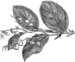
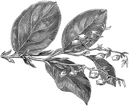
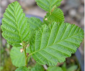
| Botanical Discoveries: Red Alder (Alnus rubra)
Cowlitz River in Oregon, March 26, 1806
Used medicinally and as a dye plant by the Native Peoples, Captain Lewis
learned of Red Alder (Alnus rubra) from visitors to the camps. He noted it in his journal
on February 9, 1806, calling it a "black alder." All that remain
of the specimen he collected on March 26, 1806, somewhere along the lower
Columbia River between Puget's Island and the Cowlitz River. He wrote on
March 27 that he "saw . . . the growth which resembles the beach."
Moulton writing in 1991 believed this meant Alnus rubra. Lewis also stated
that "the black alder appears as well on some parts of the hills as the
bottoms." On 30 Mar, Lewis mentions that "the black alder common
on the coast has now disappeared." This makes sense because today this is a
coastal specimen and grows no more than 100 miles inland, from southern
Alaska to California in modern day USDA zones 7-10.
|
 |
|
|
The Expedition's Journey
Continues:
|
Relations between the Clatsops and the expedition generally went well
through the duration of the Corps’ stay. The only negative incident
between the two groups – the Expedition’s theft of a Clatsop canoe –
was concealed from the Clatsops.
At the expedition’s departure from Fort Clatsop on March 22, 1806,
Lewis wrote in his journal that Coboway “has been much more kind an[d]
hospitable to us than any other indian in this neighbourhood.” Because
of his friendship with the expedition, Coboway was left Fort Clatsop and
all its furniture by Lewis and Clark.
The rain ceased and it became fair about Meridian, at which time
we loaded our canoes and at 1:00 P.M. left Fort Clatsop on our
homeward-bound journey. At this place we had wintered and remained from
the 7th of December, 1805, to this day, and have lived as well as we had
any right to expect, and we can say that we were never one day without
three meals of some kind a day, either poor elk meat or roots,
notwithstanding the repeated fall of rain which has fallen constantly
since we passed the long narrows on the [blank in MS.] of November last.
Indeed, we have had only [blank in MS.] days fair weather since that
time. Soon after we had set out from Fort Clatsop, we were met by
Delashelwilt and 8 men of the Chinook and Delashelwilt's wife, the Old
Bawd, and his six girls. They had a canoe, a sea otter skin, dried fish,
and hats for sale. We purchased a sea otter skin, and proceeded on.
Captain Clark, 23 March 1806
And so the Expedition turns toward home.
|
Go to our Corps of Discovery Expedition
Bicentennial Index page
to see all links in this series. Or click
here
to go directly to the next installment of our
journey.
|
 |
|
Bringing history alive: Chief
Timothy Park Alpowai Interpretive Center
This former state park is now
operated by the US Army Corps of Engineers. Chief Timothy
Park and day use area are situated on an island in the Snake
River approximately 4 miles East of Clarkston, Washington. A
very picturesque park with both a campground and day use
area, Chief Timothy Park offers a boat launch, multiple
docks, waterskiing, fishing, sandy beaches, sailing,
swimming, horseshoes, and hiking trails. The campground at
Chief Timothy Park is broken into two loops with a total of
66 camp sites. Many are full hookup and all are pull through
sites with the exception of the tent sites. Groceries and
shopping are available in both Clarkston and Lewiston. The
park is open April to October.
The park is located on the site the
Alpowai encampment of the Nez Perce Indian Tribe. It was the
home of Chief Timothy, who was a trusted friend of the early
settlers in the area. The Alpowai Interpretive Center is
built near the original site of the village that existed in
the mid 1800's. Exhibits include the story of Lewis and
Clark's meeting with Nez Perce Indians.
www.lewisandclarktrail.com/section4/wacities/clarkston/alpowai/index.htm
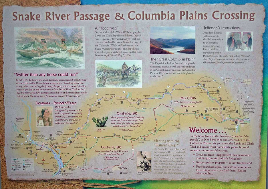
The picture below is displayed in
the park. |
 |
|