Botanical Discoveries:
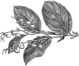
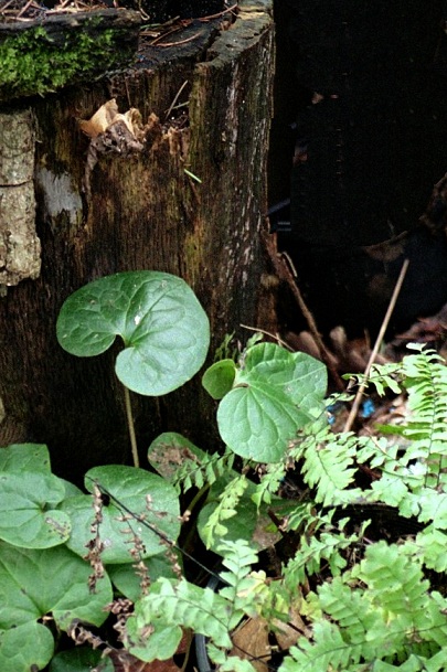
Long-Tailed Wild Ginger (Asarum caudatum)
Along Idaho's Lolo Trail, June
27, 1806
Did you ever walk through a
shaded forest and discover a carpet of plants smelling of lemon and ginger?
The heart-shaped leaves, the purplish-brown flowers with their pointed
petals, the entire Long-Tailed Wild Ginger (Asarum caudatum) plant, when
crushed, has the incredibly refreshing and intriguing aroma of lemon and
ginger combined. The exquisite aroma and the beautiful leaves are the most
often appreciated qualities of this Northwest Native perennial. The little
flowers are dainty as woodland faeries but, alas, are often shyly hiding
behind the shelter of the leaves.
Native peoples of many tribes
made tea from the wild ginger root to soothe stomach pains. They applied
this tea as poultice for headaches, intestinal or joint pains. They used the
leaves as a bath or simply rubbed them on arthritic limbs. Squamish tribes
chewed the leaves as a cure for tuberculosis. And many tribes bathed with
the leaves, considering them a good luck charm and protective wash. Aside
from the medicinal applications, the root of the wild ginger simply tastes
good and is an excellent natural flavoring wherever a taste of lemon-ginger
is desired.
Documented as the Expedition
traveled along the Lolo Trail in Idaho, this specimen is not included in the
Lewis and Clark Herbarium's collection.
|
 |
|
|
The Expedition's Journey
Continues:
All arrangements being now completed for
carrying into effect the several schemes we had planned for execution on
our return, we saddled our horses and set out. I took leave of my worthy
friend and companion, Captain Clark, and the party that accompanied him.
I could not avoid feeling much concern on this occasion, although I
hoped this separation was only momentary.
I proceeded down Clark's River seven miles with my party of nine men and
five Indians. Here the Indians recommended our passing the river, which
was rapid and 150 yards wide.
As we had no other means of passing the river, we busied ourselves
collecting dry timber for the purpose of constructing rafts. Timber
being scarce, we found considerable difficulty in procuring as much as
made three small rafts. We arrived at 11 A.M., and had our rafts
completed by 3 P.M., when we dined and began to take over our baggage,
which we effected in the course of three hours, the rafts being obliged
to return several times. The Indians swam over their horses, and drew
over their baggage in little basins of deerskin, which they constructed
in a very few minutes for that purpose. We drove our horses in after
them, and they followed to the opposite shore.
I remained myself with two men who could scarcely swim until the last. By
this time the raft, by passing so frequently, had fallen a considerable
distance down the river to a rapid and difficult part of it, crowded
with several small islands and willow bars which were now overflowed.
With these men, I set out on the raft and was soon hurried down with the
current a mile and a half before we made shore. On our approach to the
shore the raft sank, and I was drawn off the raft by a bush and swam on
shore. The two men remained on the raft and fortunately effected a
landing at some little distance below. I wet the chronometer by this
accident, which I had placed in my fob, as I conceived, for greater
security.
I now joined the party and we proceeded with the Indians about 3 miles to
a small creek and encamped at sunset. I sent out the hunters, who soon
returned with three very fine deer, of which I gave the Indians half.
These people now informed me that the road which they showed me at no
great distance from our camp would lead us up the east branch of Clark's
River and to a river they called Cokahlarishkit, or the River of the
Road to Buffalo, and thence to Medicine River and the Falls of the
Missouri, where we wished to go. They alleged that as the road was a
well-beaten track, we could not now miss our way, and as they were
afraid of meeting with their enemies, the Minnetarees, they could not
think of continuing with us any longer; that they wished now to proceed
down Clark's River in search of their friends the Shalees. They informed
us that not far from the dividing ridge between the waters of this and
the Missouri River, the roads forked. They recommended the left hand as
the best route but said they would both lead us to the Falls of the
Missouri.
I directed the hunters to turn out early in the morning and endeavor to
kill some more meat for these people, whom I was unwilling to leave
without giving them a good supply of provision after their having been
so obliging as to conduct us through those tremendous mountains.
The mosquitoes were so excessively troublesome this evening that we were
obliged to kindle large fires for our horses. These insects torture them
in such manner, until they placed themselves in the smoke of the fires,
that I really thought they would become frantic.
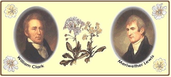
Captain Lewis, 3 July 1806
We can sympathize with the Corps' mosquito
experiences. Our mild winter didn't deplete the mosquitoes as much as
usual and as a result Oregonians are suffering the effects. Given the
diseases these pesky insects carry, we're cautioned to make sure no
standing water is available for their breeding grounds. For outdoor
activities we do recommend a smudge* instead of a large fire for holding
them at bay, especially when the weather is warm.
*Another lesson from Native Peoples, smudge your outdoor area (or your
house!) with natural materials to purify, deodorize and discourage
flying insects. Bundle small branches of
Kinnikinnik, pine, juniper
and/or cedar together with
supple grasses (or natural twine) and hang them up to dry. To use the
dried bundles, light one end and wave them around the areas you want to
cleanse. Especially address corners and protected pockets where bugs
might congregate. Aside from the spiritual connotations sacred to
Original People, a smudge will keep mosquitoes at bay as well or better
than chemicals do and they smell good as well!
Go to our Corps of Discovery Expedition
Bicentennial Index page
to see all links in this series. Or click
here
to go directly to the next installment of our
journey.
|
 |
|
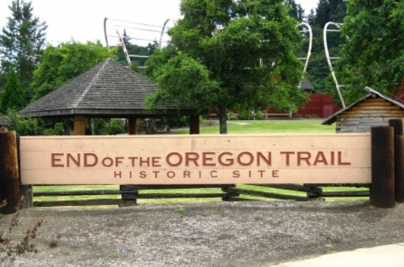
Bringing
history alive:
End
of the Oregon Trail Interpretive Center
Location:
1726 Washington Street, Oregon City, OR 97045
The End of the Oregon Trail Interpretive Center was built in 1995 on
the former Donation Land Claim of the first elected governor of the Oregon
Country, George Abernethy. A merchant and miller by trade, Abernethy had a
vested interest in the continued growth of Oregon City, so he permitted
newly arrived emigrants to park their wagons, graze their oxen, and set up
camp on a meadow behind his house. That meadow came to be called Abernethy
Green, and for many of the early Oregon Trail emigrants, it truly was the
Trail's end.
www.endoftheoregontrail.org
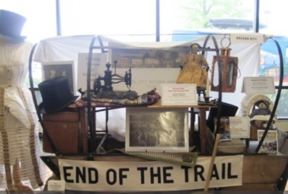
Historic Oregon City
Clackamas Heritage Partners (dba Historic Oregon City)
directs, integrates, and coordinates the development of new
and existing heritage-based programs and initiatives within
our community. We manage the Mt. Hood Territory Visitor
Center at the End of the Oregon Trail and partner with the
Oregon City Site Support Committee to preserve the City's
historical sites and attractions. CHP's mission is "to
preserve the heritage, educate the public and interpret the
history of the Oregon Trail, Clackamas County and Oregon
City; the western terminus of the Oregon Trail."
This
is a project of Clackamas Heritage Partners.
www.HistoricOregonCity.org |
 |
|